South Yuba River State Park: Swimming Holes & Gold Rush History
The Timber Giant: Bridgeport’s 1862 Covered Bridge
The centerpiece of the park’s Bridgeport headquarters is the majestic Bridgeport Covered Bridge. Built in 1862 by David Isaac Wood for the Virginia Turnpike Company, this engineering marvel was constructed during the height of the Comstock silver boom. Stagecoaches, freight wagons, and silver ore convoys needed a reliable, all-weather crossing connecting Marysville railheads to the booming mines of Virginia City, Nevada, capable of surviving ferocious winter mountain floods.
Wood designed the bridge using a combination of the Burr Arch and Howe Truss systems, spanning an astonishing 229 feet across the river without a single central support pier. It remains the longest single-span wooden covered bridge in North America:
- Architectural Ingenuity: Massive arches composed of laminated Douglas fir timbers curve up to the roofline, transferring the immense downward load directly into heavy granite abutments anchored into the river bluffs.
- The $6.9 Million Restoration: In 2011, after nearly 150 years of beating sun, river spray, and winter gales, severe timber decay and structural sagging forced state park engineers to close the bridge to foot traffic. Following a meticulous nine-year restoration effort by California State Parks and the local community—replacing rotted timbers with historic white pine and Douglas fir hewn to 19th-century specifications—the bridge was triumphantly reopened to pedestrians in November 2021.
The Flumes That Carved a Canyon: Mining and the Independence Trail
To appreciate the rugged beauty of the South Yuba canyon, one must look at the scars left by 19th-century hydraulic gold mining. In the 1850s, corporate operations upstream at Malakoff Diggins required billions of gallons of high-pressure water to liquefy gravel mountainsides with massive water cannons (*monitors*).
To transport water from high Sierra reservoirs down to the hydraulic pits, the Excelsior Canal Company engineered miles of wooden flumes and earthen ditches chiseled directly into the sheer vertical granite canyon cliffs hundreds of feet above the river. Chinese and European laborers hung from rope harnesses over the abyss, bolting heavy timber trestles into solid rock.
A century later, that destructive industrial infrastructure became a triumph of inclusive conservation. In the late 1970s, pioneering naturalist John Olmsted spearheaded the creation of the Independence Trail along the abandoned wooden flumes of the Excelsior Canal. Opened in 1980, it became the first wheelchair-accessible wilderness trail in the United States, allowing visitors with mobility challenges to roll along smooth wooden boardwalks suspended above rushing mountain streams and waterfalls.
Timing is everything on the Yuba. Never swim during the spring snowmelt (April through mid-June); torrential snow runoff turns the canyon into a freezing, deadly Class V rapid with powerful underwater siphons. The prime swimming season runs from July through September, when flows drop to gentle currents and water temperatures warm to a comfortable 68°F–72°F (20°C–22°C). Parking lots at Bridgeport, Purdon, and Edwards fill to capacity before 10:00 AM on summer weekends. Bring cash for the $5 state park day-use envelope, pack plenty of drinking water, and observe strict zero-glass rules on the granite rocks.
The Granite Sanctuaries: Iconic River Crossings and Swimming Holes
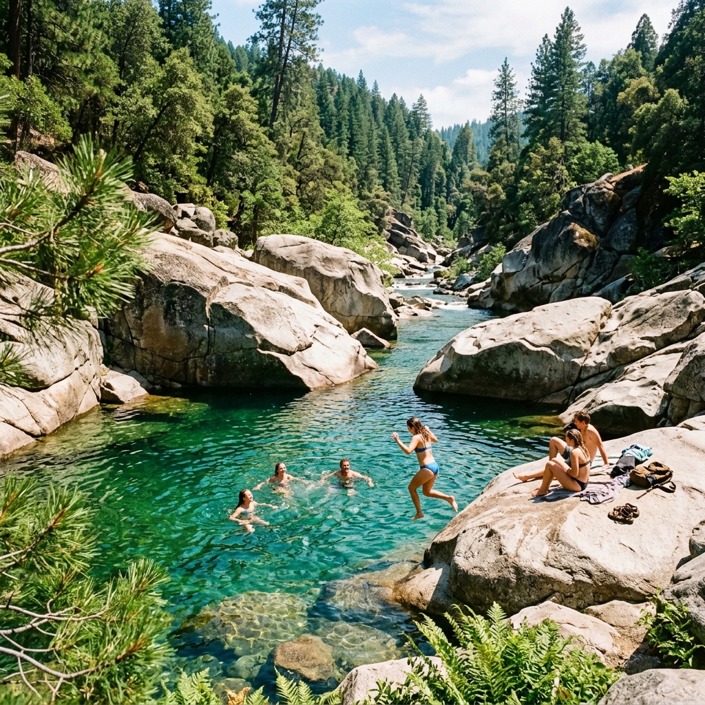
The true magic of the South Yuba lies in its polished granite riverbed. Over hundreds of thousands of years, sediment-laden waters ground smooth, sculpted bowls, deep natural diving troughs, and sun-warmed slabs into the bedrock:
- Bridgeport Beach & Family Crossing: Located right beside the covered bridge and visitor center, this stretch features broad pebble beaches, calm shallow wading areas for children, and historic walking trails past 19th-century mining barns.
- Hoyt’s Crossing: Reached via a scenic 1.2-mile dirt trail downstream from Highway 49, Hoyt’s offers a wilder, boulder-strewn canyon setting. The upper granite shelves feature clothing-optional swimming spots deeply rooted in foothill counter-culture history.
- Purdon Crossing: Situated six miles north of Nevada City along Purdon Road, this rugged crossing is framed by a historic 1895 half-through iron truss bridge. Upstream and downstream, massive granite boulders form deep emerald diving pools.
- Edwards Crossing: Marked by a beautiful wooden-decked truss bridge built in 1904, Edwards anchors the South Yuba River Trail. It is an exceptional staging ground for swimming combined with rugged backcountry canyon hiking.
Visitor Logistics and Planning Your Canyon Day
Practical advice for navigating South Yuba River State Park:
- Main Visitor Center: Located at 17660 Pleasant Valley Road, Penn Valley, CA 95946. Open year-round, featuring historic Gold Rush exhibits, pan rentals, and guided covered bridge walking tours.
- Day-Use Parking Fees: A $5 vehicle day-use fee is charged at the Bridgeport main lot. Wilderness trailheads along the river require self-pay iron ranger envelopes or a valid California State Parks Poppy Pass.
- Road Advisory: The river canyon is accessed via narrow, winding foothill roads (Pleasant Valley Rd, Purdon Rd, North Bloomfield Rd). Purdon and Edwards Crossings include steep, unpaved gravel grades that require careful driving and low speeds.
- Leave No Trace: The South Yuba canyon is an ecologically fragile mountain river. Pack out every scrap of trash, carry portable dog-waste bags, and avoid building rock cairns that disrupt native aquatic habitats.


Comments
Post a Comment